
Here is another post for my occasional series of Weardale walking routes. This route is approximately 6 miles. Starting at St John’s Chapel, the walk climbs up the northern flank of the dale before dropping down into Ireshopeburn and returning to St John’s via the southern flank. While the terrain is not difficult, there are steep climbs and descents, and one section requires basic navigation skills and a compass (there is an alternative route to avoid this section).
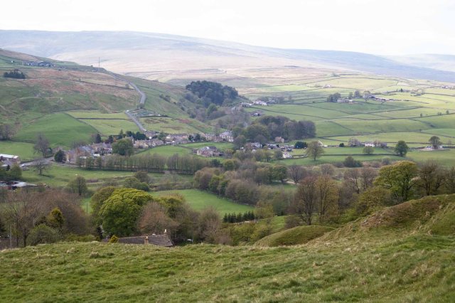
Looking down on Ireshopeburn from Hill no. 1
If you want to try this walk, you will need to take an OS map (OL31) and know how to use it. One stretch requires basic navigation skills and a willingness to clamber over walls and fences (there is an easier alternative). The directions below should be considered as a general guide only.
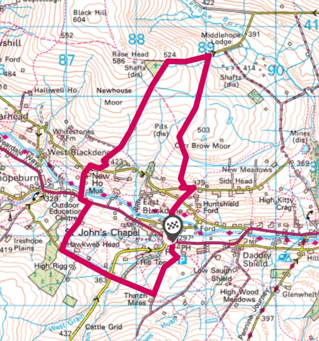
Start at St John’s Chapel. There is ample free parking next to the Farmers Mart at the east end of the village.
Head north through the village past the primary school. Do not continue along the road as it curves to the right. Bear left past the school gates; there is a footpath on your right, through a private yard and a small field (usually full of chickens), then over a narrow footbridge. (If you have come to a ford with a broad footbridge, you have missed your turning. Go back to the school).
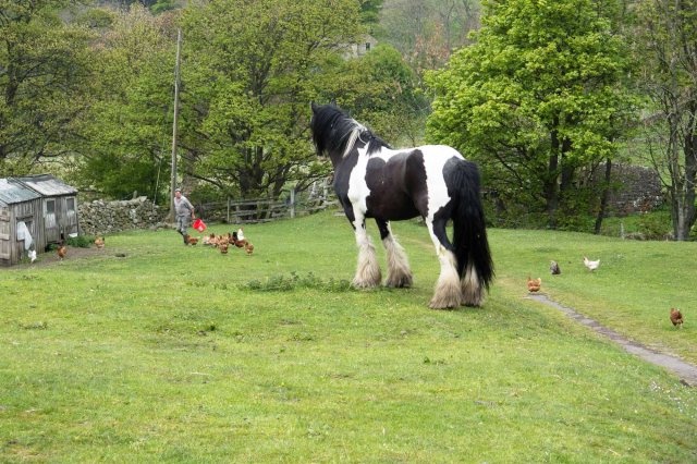
Our first field is home to a flock of chickens and this piebald cob
You will now see some stone steps straight ahead. This is the start of a long uphill section. Remember to look back at the view whenever you need to take a breather. Take the steps and continue up the hill until you come to a road. Cross the road and continue uphill through another field. When you come to another road, turn left and walk along the road for a short distance until you see a public bridleway on your right. Take this track, continuing uphill. The track is enclosed on both sides by stone walls.


Eventually you go through a gate and into a field. The bridleway continues northwards, and you can take this if you wish to avoid the next section which will need basic navigation skills – follow the bridleway all the way until you come to a road. Turn left and follow the road, skipping the next paragraph to be back on the ‘main’ route.
To continue with the ‘main’ route, shortly after you enter the field you will come to a waymarked gate on your right. The public right of way follows a bearing NNE through a number of field boundaries, with few visible navigation features. There is a faint path at times, but do not rely on it. Stay on this NNE bearing until you come over the brow of the hill. You will see some old mine workings and ponds up ahead, in front of a road. You need to cross the field boundary – a stone wall – at a point before the wall starts to curve to the right.
There is no stile, but the wall is low enough to climb easily (ducking under the top wire fence). Make your way through the next field towards the road, being careful as you are now walking over an old fluorspar mine. You will now have to exit this field, which also has no stile. It should be easy to climb through the fence, as the wire is not very taut. Alternatively, there is a gate at the bottom of the field, which you can climb over. [NB: this section is open access land with a footpath through it. You are not trespassing.]


Now you can turn left and walk along the road. Initially up hill, this road will take you back down the hill and eventually to Ireshopeburn. Stay on this road until you reach the Ireshopeburn bridge. At this point you could take the Weardale Way back to St John’s Chapel if you choose. You could also visit the Weardale Museum if it is open, which we pass when we turn left after the bridge.


Now follow the main A689 a very short way until you see a footpath across the road. Follow this track uphill until you get to High Hotts farm. Here there is a crossroads, and you want to go through the gate directly ahead, continuing uphill. After a couple of fields, you will see Hawkwell Head farm ahead. Take the gate to the left of the farm, across a gravel parking/garden area, and out onto a single track lane. Turn left and South East onto this lane, until you reach the Langdon Beck road.
Cross the road and follow the footpath on the other side, still travelling South East, which takes you down into a gorge, over a footbridge, and back up the gorge. Continue across the next few fields, still South East, until you reach a track (bridleway). Turn left and downhill along this track, which can be wet at most times of the year. There is one section that is flooded at all times of the year, but you can cross with dry feet by walking on the flat stones that stick out from the wall. This track will now take you all the way back to St John’s Chapel, right next to Chatterbox Cafe.


